We have information about 40 river traces located around North Taiwan
-
Jay
River:
阿玉溪 / A'yu riverArea:
TaipeiRegion:
NorthStart:
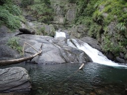
24.84466,121.58337The water is clean. Many fish. A good place for camping. Transportation: scooter, car -
Gino
River:
大屯溪 / Dà tún xīArea:
TaipeiRegion:
NorthStart:
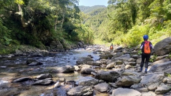
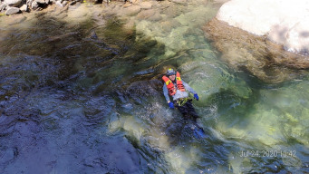
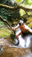
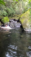
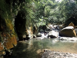
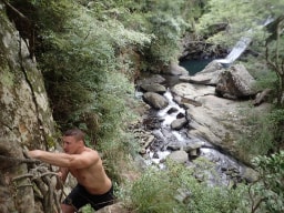
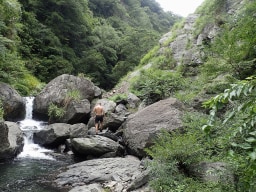
25.204307, 121.525322This is a really really easy trace as far as there not being any real difficult climbs or such along the way. I would recommend this place to beginners as it's easy to access and you shouldn't have any issues with it. It is one of the more accessible outdoor adventures in Taiwan. As it's not too far away from society I wouldn't drink the water. At c ... ertain points, you may find people BBQing. There are a few places where the water is deep enough to swim if you want. As such if you can't swim be prepared to deal with them. There is also a point further upstream you can start this trace if you want it to take a little longer located at 25.205517,121.520577. Personally, I liked the second half of the trace more but that's up to you. -
River:
瑪鋉溪 / Mǎ sù xīArea:
TaipeiRegion:
NorthStart:
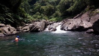
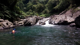
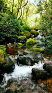
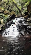
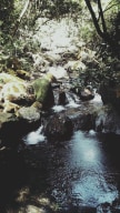
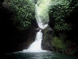
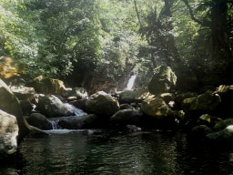
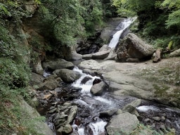
25.147693, 121.608927Really great mini gorge to climb around in. This is my personal favourite trace I have found on Yamingshan mountain. Done it a few times and seen a fair number of fish but no other notable wildlife. It isn't all that far from civilization so you see pipes and other signs of human life a few times. -
River:
老梅溪 / lǎo méi xīArea:
TaipeiRegion:
NorthStart:
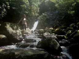
25.241758, 121.553740- You can take a bus to the trail to enter the trace or find parking at this location: 25.246974, 121.558699. Walk down the trail to the very end and you'll be able to get into the water just past where the river forks. You will in fact be on the wrong side of the fork, so you will need to backtrack downstream for around 2 minutes and get into the ... other branch located at the starting GPS point. With the exception of one climb near the end, this is a fairly easy trace. If the rope is present even that isn't much. Clean water, with tons of frogs. -
River:
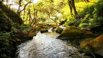
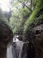
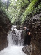
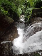
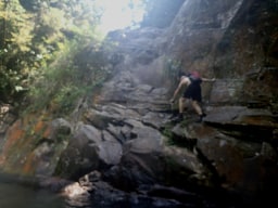
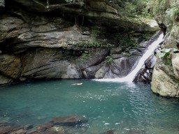
寶里苦溪 / Bǎo lǐ kǔ xīArea:
TaoyuanRegion:
NorthStart:
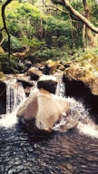
24.717189, 121.346930Really great trace, one of my favourites that I have been able to visit in Northern Taiwan. The water is clean, and the entire area feels quite natural (sans the very start where people hang out). The GPS should take you to a bridge. You will be able to get down and start the trace via a path on the right-hand side of the bridge. In the very first ... area, it's possible you will run into people. Once you climb the ropes along the side to pass the first waterfall you should have the place almost entirely to yourself. You may run into various waterfalls that seem impassable, there is generally a trail located somewhere around them that will take you up and over them.